Projects IdeaWood P.04

Mapy

A web map and the map inside the Sysel mobile app for forest managers, which we designed as a team and I built: your own forest management plan (LHP), cadastre and orthophoto, drawings from the field and tasks with a deadline.

Role
Design, development
Period
2026 → present
Scope
Web map and the map inside the Sysel mobile app, LHP import, map tiles, drawings and tasks (including the part of the WoodSoft backend for drawings and tasks)
Status
In production

Product site at ideawood.cz ↗

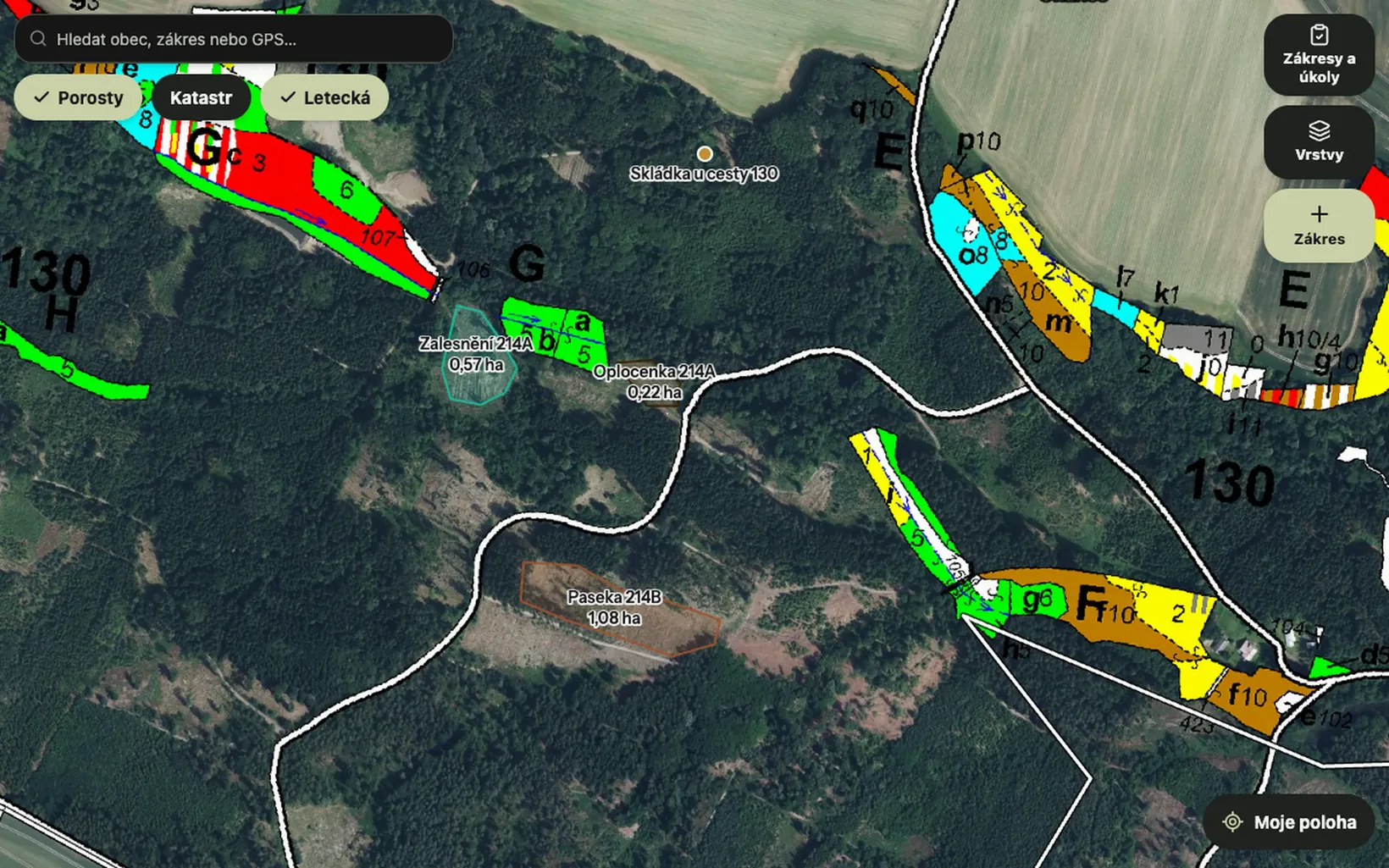
Orthophoto with the stand map and four drawn areas with name and area. Sample data, no real customer.
Fig. 1 · Orthophoto with the stand map and four drawn areas with name and area. Sample data, no real customer.

The brief

Mapy is a tool for forest managers that runs in the browser and inside the Sysel mobile app. The forester sees the stands from their own forest management plan (LHP), orthophoto, cadastre and other public maps (ÚHÚL, LČR, LPIS). They draw areas on the map and create tasks from those drawings.

We designed the map as a team and I built it, including the part of the WoodSoft backend for drawings and tasks. It is sold publicly as Sysel pro lesní hospodáře (Sysel for forest managers).

What is worth mentioning

01

Your own forest management plan in the map

A company gets its forest management plan (LHP) as a ZIP or XML file. It is uploaded to the web, and a few minutes later the plan is visible on the phone and on the computer as a map with stands, felling and management measures. Each stand has an extract from the stand register. The map is not redrawn on every pan: the finished tiles are prepared in advance and the server just hands them out, so the plan opens quickly even on a phone.
02

Downloading an area to the phone and a map without signal

There is often no signal in the forest, so the forester downloads the area beforehand and the map, orthophoto and cadastre keep working. The downloaded area stays in the phone, also in the map inside the Sysel app. Drawings made without a connection are sent as soon as the phone is online. The tiles are stored directly in the phone's files, because the browser storage in iOS turned out to be unreliable.

03

A task from a drawing, assigned by link or SMS

A forester in the field draws an area, for example a clearing or a fenced plantation, and the office turns it into a task with a deadline. The task is assigned to a colleague, a contact from the address book or anyone else by link or SMS. The assignee gets the place and navigation, the task status changes in the notes history, and the finished work is confirmed with a photo and a note.

What it looks like

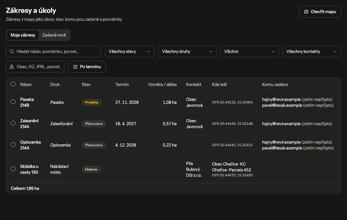
The web screen Drawings and tasks: filters and rows with status, deadline, area, contact and assignee
Fig. 2 · Web list of drawings and tasks with a filter by status, deadline and municipality.
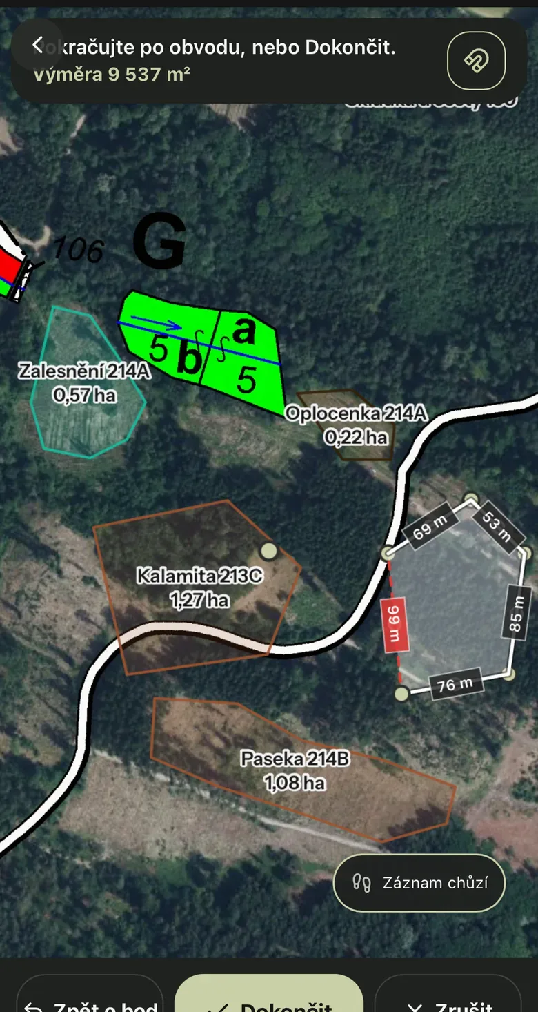
A phone with a map where an area is being drawn: side lengths along the edges and the total area at the top
Fig. 3 · Drawing an area in the field: side lengths and area are shown while you draw.
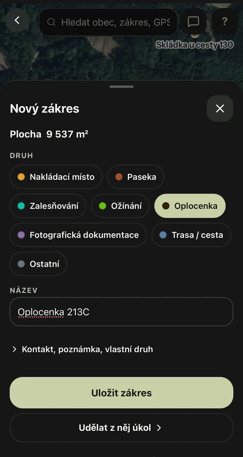
The New drawing form on the phone with a choice of area type, a name and a button to turn it into a task
Fig. 4 · New drawing: area type, name and the option to turn it into a task.
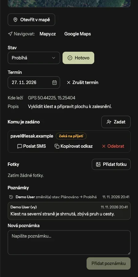
A task detail with navigation links, the status In progress, a deadline, an assignee and a thread of notes
Fig. 5 · Task detail with status, assignee and a thread of notes.

What it runs on

  • React
  • TypeScript
  • Vite
  • OpenLayers
  • proj4
  • MapProxy
  • QGIS Server
  • Hono

The map runs in the browser and inside the Sysel app and is drawn natively in S-JTSK; the server hands out ready-made forest plan tiles from a cache, the WoodSoft backend stores drawings and tasks, and a downloaded area stays on the phone for work without signal.

Mapy architecture The web map and the map inside the Sysel app both connect to the map server, which serves tiles and layers. The server reads ready-made tiles from the tile cache and forwards layers from public state maps. The WoodSoft backend stores drawings and tasks, which the web map and the app send to it directly, and hands an uploaded forest plan to the server to be rendered. A downloaded region stays on the phone for work without signal. WEB MAP (REACT, OPENLAYERS) MAP IN THE SYSEL APP MAP SERVER TILES (QGIS SERVER, MAPPROXY) PUBLIC STATE MAPS WOODSOFT BACKEND

I describe how I build systems like this on the How I work page.

Want to build something similar?

Get in touch →